Library Tour – Rare Atlas of China
TBC’s Anton Library has not only the first Confucian work in a Western language to be published in Europe – Confucius sinarum philosophus, sive, Scientia Sinensis Latine exposita – but also the first Western-made and published atlas of China. If you’re curious about the Confucian work, check out our blog post here.
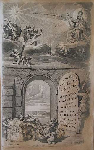
In the mid-seventeenth century, as the first full atlas of East Asia became available on the European book market, a dramatic shift took place in textual and visual representations of the Far East. The atlas, Novus Atlas Sinensis (1655), was the product of a cooperation between Joan Blaeu (ca. 1599-1673), who headed one of Europe’s foremost commercial publishing houses, and Martino Martini, a prominent Jesuit missionary to China.
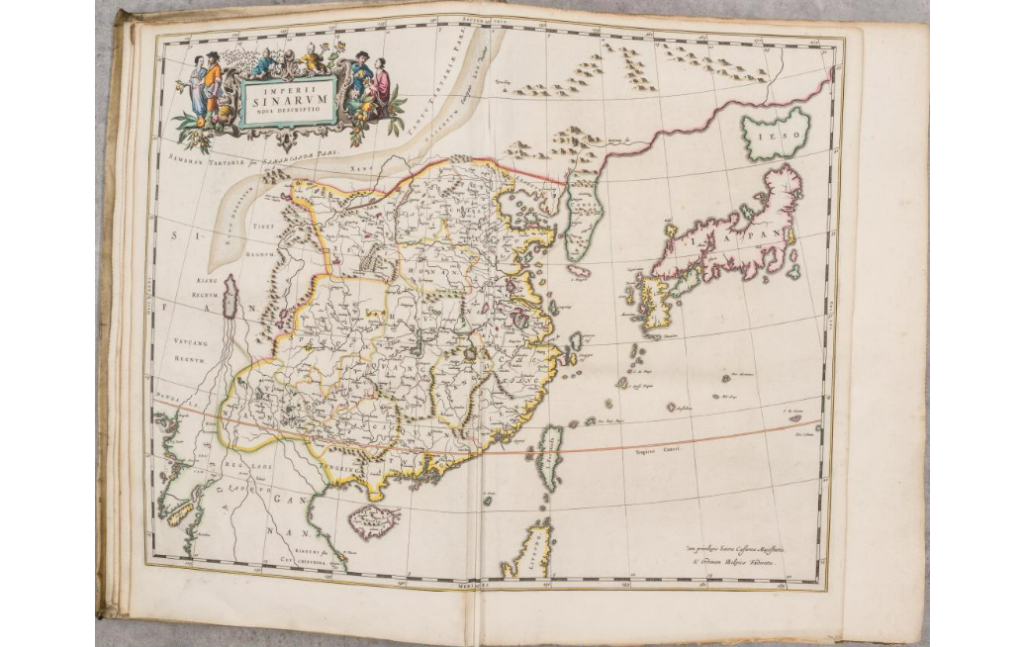
Martino Martini drew this map mainly based on Guang Yu Ji (广舆记), a Chinese geographical book published in late Ming Dynasty, which Martini brought back to Europe. After the book was published in Amsterdam in 1655, it had a great influence on European knowledge of China at that time.
Martini’s New Atlas of China constituted the best atlas of China for a whole century after its publication. It consists of about 200 pages of text and 17 maps – a general map of China, 15 maps of individual Chinese provinces, and a general map of Japan as well. All of them are in beautiful original outline and hand-colored.
After its original publication, it was republished as part of Joan Blaeu’s Atlas Maior (1662). The text largely belongs to the genre of descriptive geography, as it begins with a general sketch of Chinese culture and goes on to describe the whole of the country province by province and city by city. However, this description is followed by a catalogue of the coordinates of all Chinese cities on 20 pages (the prime meridian running through Beijing).
The seventeen maps are noteworthy not only for their accuracy, remarkable for the time, but also for their highly decorative cartouches featuring vignettes depicting regional Chinese dress, activities, and animals. In addition, it is one of the first true Sino-European publications, based on Chinese land surveys but presenting geographic data in a highly visual European cartographic format.
-from “China on Paper: European and Chinese Works from the Late Sixteenth to Early Nineteenth Century” (2011) by M. Reed and P. Dematte
Mario Cams’ research in Displacing China: The Martini-Blaeu Novus Atlas Sinensis and the Late Renaissance Shift in Representations of East Asia also probes deeply into this book. Published in the 2020 Renaissance Quarterly, this study shows how the Novus Atlas Sinensis thoroughly challenged the worldview of late Renaissance audiences by tracing and reconstructing a series of displacements that facilitated its production process.
Novus Atlas Sinensis remains the standard geographical work on that country until the publication in 1737 of D’Anville’s Atlas de la Chine. To read this remarkably accurate and technically excellent work, you can place a bid at €10.000 from Arenberg Auctions, or you can read it at TBC for free by request.
By Suemmer Luo, TBC Intern